

Travel has always been a way to indulge my curiosity in places and their history. Visiting familiar places but always discovering something new is what keeps bringing us back. Here is the second part of my summer post.
Venice, the Floating City
Venice is most famously known as the Floating City or the City of Canals. The vaporetti, the public water buses, and the motoscafi, the private water taxis, shuttle people around the city’s extensive network of canals. There simply were and are no cars anywhere to be found. As a consequence, the city is connected by wonderful, picturesque pedestrian walkways. The connections between land and water are handled via bridges and specific vaporetto stops.The Network of the City Streets
I do not think I will ever be able to completely navigate Venice without the map on my phone, no matter how often I visit. The city is a labyrinth, with almost no visible landmarks on which to orient oneself when looking up. As we walk through the streets, there is no hierarchy to the width, length, or directional orientation to help one navigate. With the many different islets (118 actually) physically separated by canals, one is constantly on a bridge or a cul-de-sac. Only a few continuous routes connect the Grand Canal to different districts.
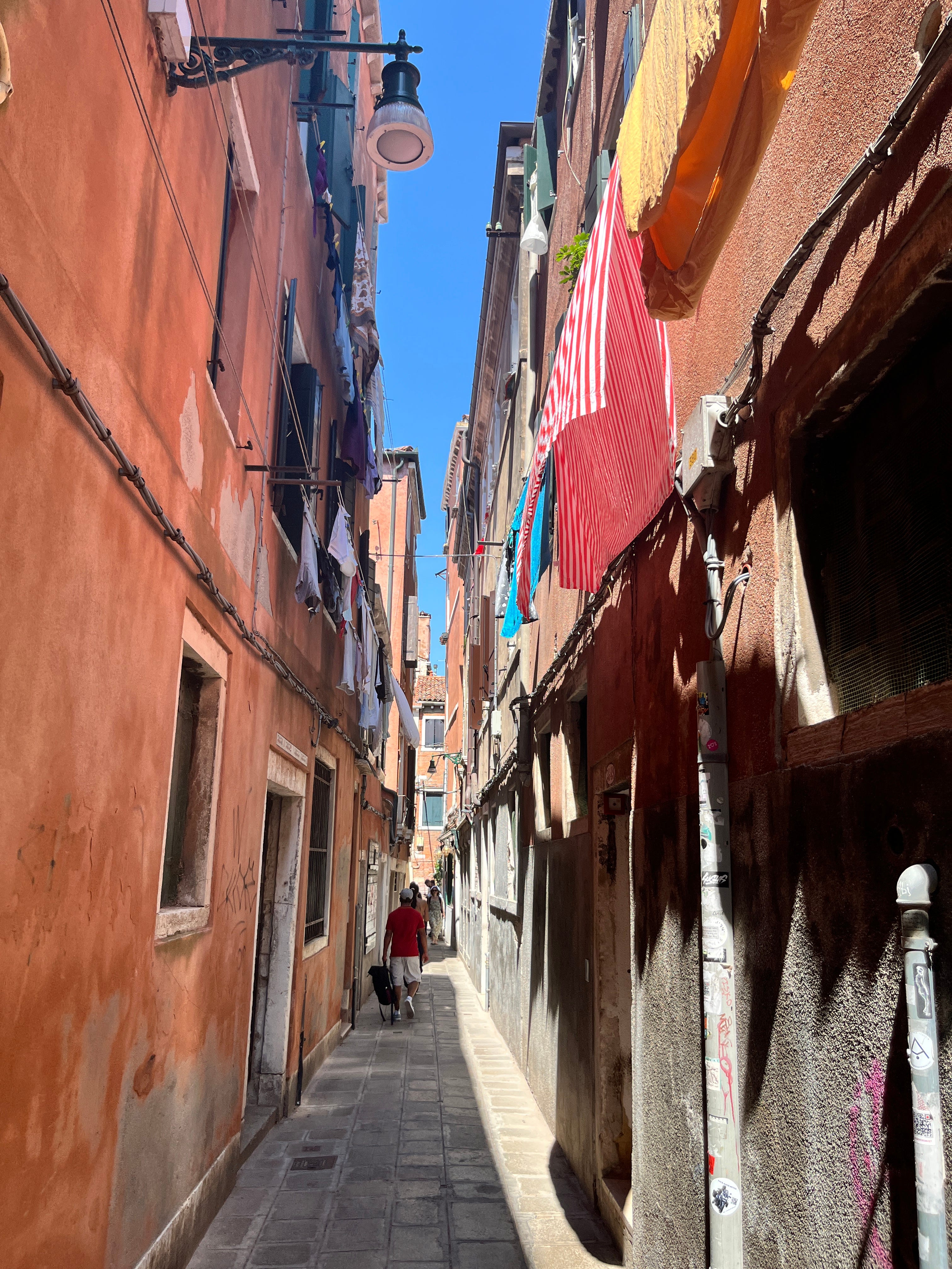
On the other hand, one is usually pleasantly surprised when turning a corner to find an interesting shop. Or, to find a restaurant whose tables and crowds spill outside only when the sun has set. These are the hidden local social spaces in the respective neighborhoods. One even finds small altars to some saint in a wall alcove, or perhaps some artist’s work (a Banksy or a robot). The lack of alternative cross-district routes from different points means that everyone — commuters, residents, and tourists — is forced through the same paths. This is generally a good thing: when one is lost, it’s easy to just follow the flow of the crowd. Especially so on a sunny weekend in spring or fall, which brings an average of 70,000 day-trippers.
The Ancient Venetians Knew the Value of Urban Planning
By its nature, without cars, the city has natural superblocks. The term superblocks represents the historical and contemporary tension in urban planning. The most successful modern superblock initiatives — most notably Barcelona’s Superblocks (”superilles”) launched in 2016 — actively work to reverse modernist isolation by reclaiming existing urban grids. They consolidate smaller blocks or districts in a city, giving the interior streets back to the community. Traffic is taken away from these areas. These calm environments allow for spontaneous “micro-interactions” — such as neighbors chatting or greeting local shopkeepers.
The interior streets connect and create squares, campi, that are outdoor living spaces for the community. Many of them were designed with wells. Some have water fountains or water pumps that tourists flock to in summer. They typically also offer a bit of shade from the buildings or some trees, and a place to rest with some benches. For the locals, the campi are the dedicated space for children to play, teenagers to gather, and older adults to sit and converse comfortably on benches. As one enters from a calle, the light flapping of the washing lines welcomes people in greeting. Sometimes we found notices posted up with births and deaths of community members.
Some older cities have such natural boundaries, like water or mountains, to keep out intrusive city planning. It makes it easier to build and maintain such community-first living. What is your favorite old city?